
On the Kedarkantha trail in Uttarkashi district, January 2019. It is the best-known winter trek in the state and the busiest from mid-December to mid-January. Photo © Sachinbauriyan, CC BY-SA 4.0, via Wikimedia Commons.
The snow treks of Kumaon and Garhwal side by side, from a morning walk above Nainital to five days over Kuari Pass, with the days, the height, the nearest station and the rules that apply this winter.
The short answer: the winter treks of Uttarakhand run from December to February, and some into March, and the well-known snow treks are in Garhwal: Kedarkantha, Brahmatal, Kuari Pass, Dayara Bugyal and Tungnath with Chandrashila, each five or six days door to door with a top between about 3,600 m and 3,875 m. Nag Tibba is the easy two or three day option from Dehradun. From Kathgodam the snow trek within reach is Brahmatal, whose road head at Lohajung is about 200 to 220 km away, while Kumaon itself offers shorter winter walks: Naina Peak above Nainital, Binsar Zero Point and, for the fit, Khaliya Top above Munsiyari. The Supreme Court lifted the ban on camping in the high meadows on 20 July 2026, and the state’s new trekking rules were still a draft when we checked on 16 October.
By Nandini Upreti, Contributor, Almora. About the author ↓
Four things decide which winter trek suits you, and the name of the trek is the least of them. The first is height. Snow in Uttarakhand settles mostly above about 2,000 m and reliably only higher, so a trek that tops out near 3,000 m may be bare in a dry January while one near 3,800 m is almost always white. Our guide to where it snows in Uttarakhand has the dated record for the last three winters.
The second is days. The Garhwal snow treks are sold as five or six days, but only three or four of those are on foot; the rest is the drive in and out, which from Dehradun or Rishikesh takes eight to eleven hours each way. A long weekend is enough only for Nag Tibba or a walk in Kumaon. The third is difficulty, and here the operators’ ratings run from “easy” to “moderate” for every trek on this page. In winter none of them is easy: the days are short, the paths are icy in the morning and the nights are well below freezing.
The fourth is where your train stops. Kumaon’s station is Kathgodam, 5 km above Haldwani; Garhwal’s are Dehradun, Haridwar and Rishikesh. Most of the famous winter treks start closer to the Garhwal stations, which is worth knowing before you book a ticket to Kathgodam for Kedarkantha. Brahmatal is the exception, reachable from either side.
| Trek | Starts from | Nearest station | Days | Highest point | Snow months | How hard |
|---|---|---|---|---|---|---|
| Naina Peak (Nainital) | Snow View or Barapathar | Kathgodam | Half a day | 2,611 m | Some days, Dec to Feb | Easy walk, slippery after snow |
| Binsar Zero Point (Almora) | Inside Binsar sanctuary | Kathgodam | An hour or two | about 2,400 m | Some winters | Easy, 2 km |
| Khaliya Top (Munsiyari) | Balati Band | Kathgodam | One long day | about 3,500 m | Dec to Mar | Steep, hard in deep snow |
| Nag Tibba | Pantwari, Tehri Garhwal | Dehradun | 2 to 3 | about 3,020 m | Dec to Mar | Easy |
| Kedarkantha | Sankri or Kotgaon, Uttarkashi | Dehradun | 5 to 6 | about 3,800 m | Dec to Feb | Easy to moderate |
| Dayara Bugyal | Raithal or Barsu, Uttarkashi | Dehradun | 5 to 6 | about 3,600 to 3,750 m | Dec to Mar | Easy to moderate |
| Brahmatal | Lohajung, Chamoli | Kathgodam or Rishikesh | 6 | about 3,730 to 3,850 m | Dec to Feb | Easy to moderate |
| Tungnath and Chandrashila | Chopta or Sari, Rudraprayag | Haridwar or Rishikesh | 1 to 5 | about 3,680 m | Dec to Feb | Easy to moderate |
| Kuari Pass | Dhak or Karchi, near Jyotirmath | Haridwar or Rishikesh | 5 to 6 | about 3,815 to 3,875 m | Dec to Mar | Moderate |
Heights for Naina Peak and Binsar are from the Nainital district and the Government of India’s tourism site. For the Garhwal treks, days, distances, difficulty and heights are from the itineraries that at least two trekking operators publish for winter 2026-27; they do not agree, so we give the range. “Days” counts door to door from the nearest town with a station, drive days included.
Kumaon has no multi-day snow trek of the kind Garhwal is known for, and that is the honest place to start. What it has are winter walks that start an hour or a day from Haldwani and reach real snow in most winters, without camping.
Naina Peak, also called China Peak, is the highest point above Nainital at 2,611 m by the district’s figure, and a 6 km walk or pony ride from Snow View or Barapathar. Snow reached it in each of the last three winters, most recently on 23 January 2026. Since June 2026 the Forest Department has allowed 150 people a day on the trek, at Rs 50 each, so arrive early on a snow morning. Tiffin Top (2,292 m) is the shorter walk, about 4 km from town, but Dorothy’s Seat, the old bench on top, collapsed in a landslide on the night of 6 August 2024. Kilbury (2,194 m), 12 km from Nainital, and Pangot beyond it are quieter forest walks and good for birds; on 12 January 2025 the road to them had to be cleared of snow by JCB. Month-by-month odds are in our Nainital snowfall guide.
Binsar Wildlife Sanctuary is about 30 km beyond Almora, and Almora is 87 km from Haldwani, so it is a long day or, better, a night inside the sanctuary. The walk to Zero Point, the sanctuary’s highest lookout at about 2,400 m, is 2 km, and on a clear winter morning it looks straight across at the snow range. The district lists October to March as the best season. Snow at Binsar is less certain than at Mukteshwar: of the last three winters, it came only in January 2026. The road is covered in our Haldwani to Almora guide.
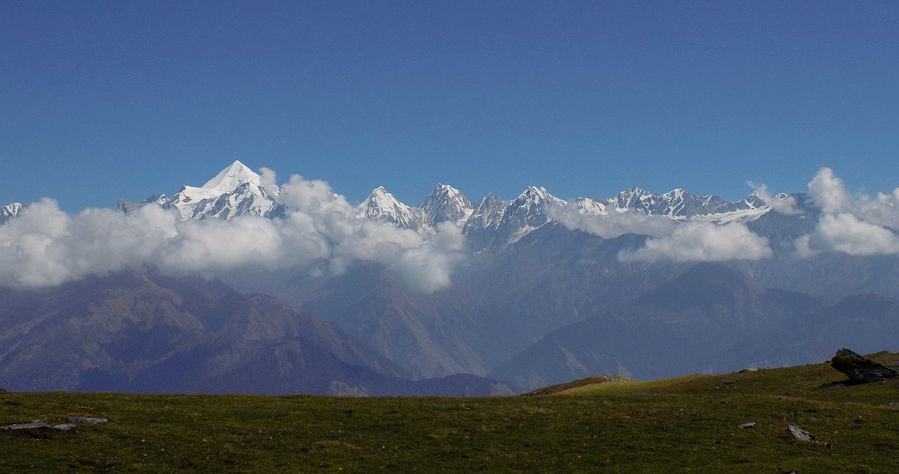
Khaliya Top is the one real snow climb in Kumaon that winter visitors make. The path starts at Balati Band on the road into Munsiyari and climbs about 6 km through forest to a meadow at around 3,500 m, facing the Panchachuli peaks; the round trip takes most of a day. It gets heavy snow every winter: two and a half feet on 5 February 2024 by Amar Ujala’s report, and still three inches on 20 March 2026. That depth is the risk. On 5 February 2026 a group of tourists lost the path at Khaliya and police brought them down late at night through two and a half to three feet of snow; the same report noted that phones often lose signal up there. Go with a local guide, start early and turn back by early afternoon. Munsiyari is about 280 km and ten to eleven hours from Haldwani, so plan two nights at least.
People often ask about Pindari, Kafni and Sunderdhunga in Bageshwar district, or the Panchachuli base camp in the Darma valley, for a winter trip. They are autumn and spring treks. The forest department shuts the Bageshwar glacier routes from 15 June to 15 September for the monsoon, and gives April to July and September to October as the trekking months; it registers every trekker at its Khati and Hichauri check posts. When the first snow came near Pindari on 8 October 2025, the district magistrate stopped further permissions. The Darma villages on the way to Panchachuli are lived in from April to October and empty in winter. The Almora district also lists two walks, Dunagiri to Pandukholi and Binsar to Jageshwar, but publishes no route details for them.
These are the treks most people mean by “winter treks in Uttarakhand”. All of them are sold by many operators as fixed departures with guides, tents and meals included, and most trekkers go that way. They are listed here from the one closest to Kathgodam to the furthest.
Brahmatal starts at Lohajung in Chamoli district and climbs over four days to a frozen lake and a ridge top at about 3,730 to 3,850 m, about 22 to 28 km in all. It is the snow trek that suits a Kathgodam ticket. The road to Lohajung runs through Almora, Gwaldam and Dewal, about 200 to 220 km, and shared jeeps leave from outside Kathgodam station early in the morning for a full day’s drive; from Rishikesh it is about 270 km and ten to eleven hours. Operators run it from December to February and into spring, but warn that in the heaviest snow the lake and the top may not be reachable, and that the Lohajung road itself can close for a day or two after a big fall.

Kuari Pass is rated the hardest of the group and, on a clear day, has the widest view, with Dunagiri, Kamet, Chaukhamba and Hathi Parbat in one sweep. The trek starts at Dhak or Karchi, about 16 km from Jyotirmath (the town was called Joshimath until 2024), crosses the meadows of the Nanda Devi Biosphere Reserve to a pass at about 3,815 to 3,875 m, and usually comes down to Auli; five or six days, 22 to 30 km. Rishikesh to Dhak is about 255 km, nine to ten hours. Snow lies from December to the end of March, and when the Gorson meadow is too deep to cross, operators change the route. One operator also asks for a medical check at the Jyotirmath government hospital before the start. The road to Auli is the one most often closed by snow: Chamoli police shut it on 24 January 2026 until it was cleared, and in January 2025 and 2026 only four-wheel-drive vehicles were allowed past the TV Tower bend.

From Chopta in Rudraprayag district, the stone path to Tungnath, the highest of the Panch Kedar temples, is about 3 km, and Chandrashila is another 1.5 km and some 180 m higher, at about 3,680 m. Done from Chopta it is a single long day; operators sell a five-day loop from Sari village that adds Deoria Tal. Rishikesh to Sari is about 190 km, seven to eight hours. Winter brings two complications. The temple closes in early November, on 6 November in 2025, and its deity spends the winter at Makkumath; at a meeting at Duglavitta on 12 January 2026 the local administration decided that tourists would not be allowed up to Tungnath in winter after the doors close, and that a new path to Chandrashila would be planned. We found no report that the new path is ready for this winter, so ask at Chopta before you go. The other is the road: on 23 and 24 January 2026 snow blocked the Ukhimath and Mandal approaches to Chopta and hundreds of visitors were stuck. Walking off the path on the meadows is also fined; ETV Bharat reported 102 visitors fined under the Forest Act on this route in July 2025. For where Kedarnath, Badrinath, Gangotri and Yamunotri are worshipped while their temples are shut, see our guide to the Char Dham yatra in winter.

Kedarkantha is the trek most first-timers choose, and from mid-December to mid-January the camps above Sankri show it. It starts at Sankri, or at Kotgaon 5 km on, in the Mori area of Uttarkashi district, inside Govind Pashu Vihar; trekkers show a government ID and take permission at the Naitwar barrier on the way in. The summit is about 3,800 m and the route about 22 to 23 km over four days on foot, six days door to door. Dehradun to Sankri is about 195 km, eight to nine hours, and the return drive is often longer. It is run all winter, with departures listed every week of January 2027, but the snow is not guaranteed: in the dry start to 2025-26, operators reported only a little snow on the route at the beginning of January, and the first heavy snow across the state came on 23 January 2026.
Dayara is a wide alpine meadow above the Bhagirathi valley in Uttarkashi district, reached from Raithal or Barsu. Its top is at about 3,600 to 3,750 m and the trek covers about 21 to 24 km in five or six days. Dehradun to Raithal is about 185 to 200 km, eight to nine hours, and the district hospital at Uttarkashi is about an hour below the road head. Dayara is a bugyal, a high meadow, and the camping rules for bugyals changed this year; see the rules below.

Nag Tibba is the short one: two or three days from Pantwari in Tehri Garhwal, about 16 to 20 km in all, to a top at about 3,020 m. Pantwari is about 90 km from Dehradun, three to four hours, which makes it the only snow trek on this page that fits a long weekend. Because it is the lowest, it is also the one most likely to be bare in a dry January.
Camping in the high meadows is allowed again. In August 2018 the Uttarakhand High Court banned overnight stays on the bugyals and capped visitors at 200 a day per meadow. On 20 July 2026 the Supreme Court set those two directions aside, along with the proposal to turn the bugyals into a national park, and kept the rest of the order: no permanent structures, rubbish to be carried out, limits on grazing. The Badrinath Forest Division wrote to its range officers on 27 July to apply the change. For Kuari Pass, Dayara and Brahmatal this means camps on or near the meadows should again be possible, under the forest department’s conditions; ask your operator where its camps will be.
The state’s trekking rules are still a draft. After nine trekkers from Karnataka died in a blizzard near Sahastra Tal in June 2024, the tourism and forest departments drafted the Uttarakhand Trekking Niyamavali 2026. As reported by ETV Bharat in January 2026, it would make every trekking agency register, require trekkers to carry a medical certificate and insurance, make agencies check the weather before each trek and halt it if the weather turns, and fine offenders up to Rs 10,000. In July the Chief Secretary asked for it to go to the cabinet in August; we found no report of its approval by 16 October 2026, so none of it is yet in force.
Forest permission and fees. Kedarkantha lies in Govind Pashu Vihar, Tungnath and Chandrashila in the Kedarnath Wildlife Sanctuary and Kuari Pass in the Nanda Devi Biosphere Reserve, and on these routes the forest department collects an entry or camping fee at its check post, higher for foreign nationals. We could find no official fee schedule for any of the Garhwal treks, and the figures quoted online differ widely, so we do not print one; operators normally include it in the package. In Kumaon, the Naina Peak fee is Rs 50 with the 150-a-day cap. Pithoragarh district has, since May 2026, required every trekker on its high routes, such as Milam, Ralam, Darma and Panchachuli, to register in advance by email with the district tourism office, giving name, address, mobile number, age and Aadhaar.
The cold on these treks is easy to underestimate from the plains. Mukteshwar, at 2,286 m, has an average January low of 1.7 °C by IMD’s 1991-2020 normals, and air cools by roughly 6.5 °C for every 1,000 m you climb. That puts an average January night at about minus 5 °C in a camp at 3,300 m and about minus 8 °C on a 3,800 m summit, before any wind. A clear night after fresh snow is colder still.
Dress in layers you can take off as you climb and put back on when you stop: a thermal base layer, a fleece, a down or synthetic jacket and a wind- and waterproof shell, with a warm cap, liner gloves under waterproof gloves, and two pairs of wool socks. Proper trekking shoes with a deep grip matter more than anything else; many operators provide microspikes and gaiters for the snow days, so ask whether yours does. Carry sunglasses, because snow glare at this height burns the eyes, and sunscreen. Water bottles freeze overnight unless they sleep in your bag.
If you are coming by train, choose the station by the trek. Kathgodam suits Naina Peak, Binsar, Khaliya Top and Brahmatal. The overnight Ranikhet Express from Delhi reaches it early in the morning and the Shatabdi before midday; check the current times on the railway enquiry site, because in December and January fog on the plains makes the night trains run late and some services are cut back for the season. Our Uttarakhand in winter guide lists last winter’s cancellations. The three Delhi trains, their times and how late they run in fog are in our guide to the Delhi to Kathgodam train. If you arrive late, the hotels near Kathgodam station are closest, and for a dawn start a cab from Haldwani is easier than waiting for the first shared jeep.
Dehradun is the station for Kedarkantha, Dayara and Nag Tibba, and Haridwar or Rishikesh for Tungnath, Chandrashila and Kuari Pass. Most operators collect their groups from Dehradun or Rishikesh early in the morning, which usually means arriving the evening before. From Haldwani, every Garhwal start except Lohajung is a long day’s drive across the state, so a Kumaon trip and a Garhwal trek are best planned as two separate holidays.
Whichever you pick, give the weather a day either side. Snow closes roads before it closes trails, and the trek you booked in October may meet a road shut by the same snowfall you came for. The district closures are posted on the state public works department’s road closure page, and 112 is the emergency number anywhere in the state.
Nag Tibba, above Pantwari in Tehri Garhwal, is the easiest overnight snow trek: two or three days, about 16 to 20 km in all, to a top of about 3,020 m, and Pantwari is about 90 km from Dehradun. From a Haldwani base the easiest snow walk is Naina Peak above Nainital, 2,611 m, a 6 km walk from Snow View or Barapathar. Of the longer treks, Kedarkantha, Dayara Bugyal and Brahmatal are rated easy to moderate.
Yes. Kedarkantha is run right through the winter, from December to February, and operators list departures every week of January; it closes only in the monsoon. Snow is not guaranteed: in 2025-26 there was only a little on the route at the start of January, and the first heavy snow came on 23 January. The trail is busiest from Sankri between mid-December and mid-January.
For a day walk, Naina Peak above Nainital, about 40 km from Kathgodam. For a multi-day snow trek, Brahmatal: its start, Lohajung in Chamoli, is about 200 to 220 km from Kathgodam by Almora, Gwaldam and Dewal, and shared jeeps leave from outside Kathgodam station early in the morning. Khaliya Top above Munsiyari is about 300 km from Kathgodam.
There is no single statewide trek permit yet; the state's trekking rules were still a draft on 16 October 2026. Treks inside protected areas, such as Kedarkantha in Govind Pashu Vihar and Tungnath and Chandrashila in the Kedarnath Wildlife Sanctuary, need forest permission and a fee at the check post, which operators usually arrange. Pithoragarh district requires advance registration by email for its high routes, and Naina Peak takes 150 people a day at Rs 50 each.
Colder than most people pack for. Mukteshwar, at 2,286 m, has an average January low of 1.7 °C by IMD's 1991-2020 normals, and air cools by roughly 6.5 °C for every 1,000 m, so an average January night is about minus 5 °C in a camp at 3,300 m and about minus 8 °C at 3,800 m, before wind. Pack several thin layers, a down jacket, waterproof gloves and wool socks.